|
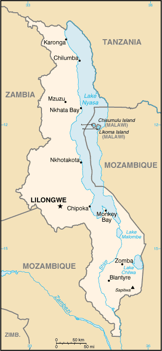
Area: total: 118,484 sq km country comparison to the world: 100 land: 94,080 sq km water: 24,404 sq km Area - comparative: slightly smaller than Pennsylvania Land boundaries: total: 2,881 km border countries: Mozambique 1,569 km, Tanzania 475 km, Zambia 837 km border bodies of water: Lake Malawi Coastline: 0 km (landlocked) |
|
|
|
Climate: sub-tropical; rainy season (November to May); dry season (May to November) Terrain: narrow elongated plateau with rolling plains, rounded hills, some mountains Elevation extremes: lowest point: junction of the Shire River and international boundary with Mozambique 37 m highest point: Sapitwa (Mount Mlanje) 3,002 m |
Information found at
https://www.cia.gov/library/publications/the-world-factbook/geos/mi.html
